

What Bear Lake Isn't Telling You
What You See
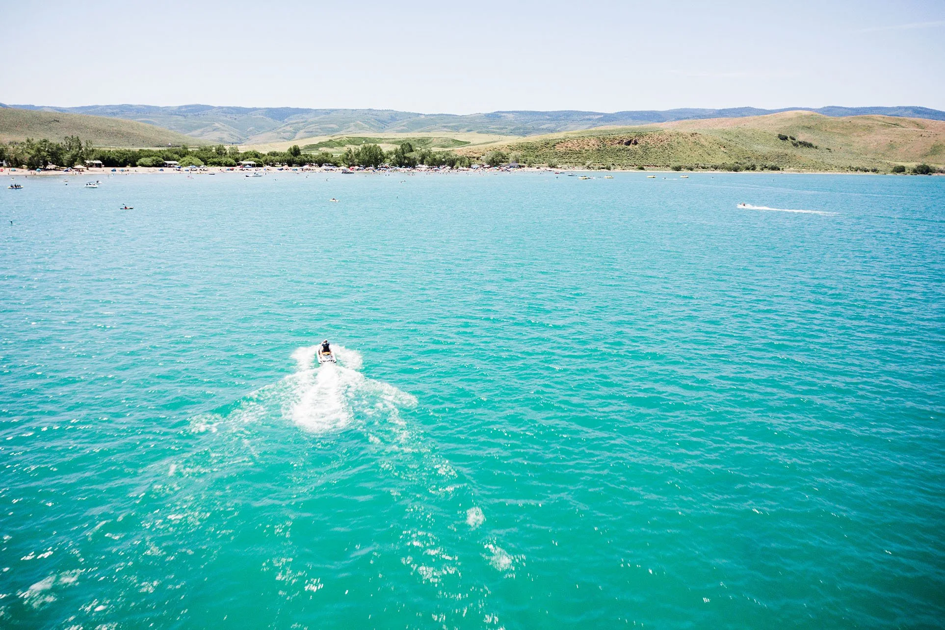
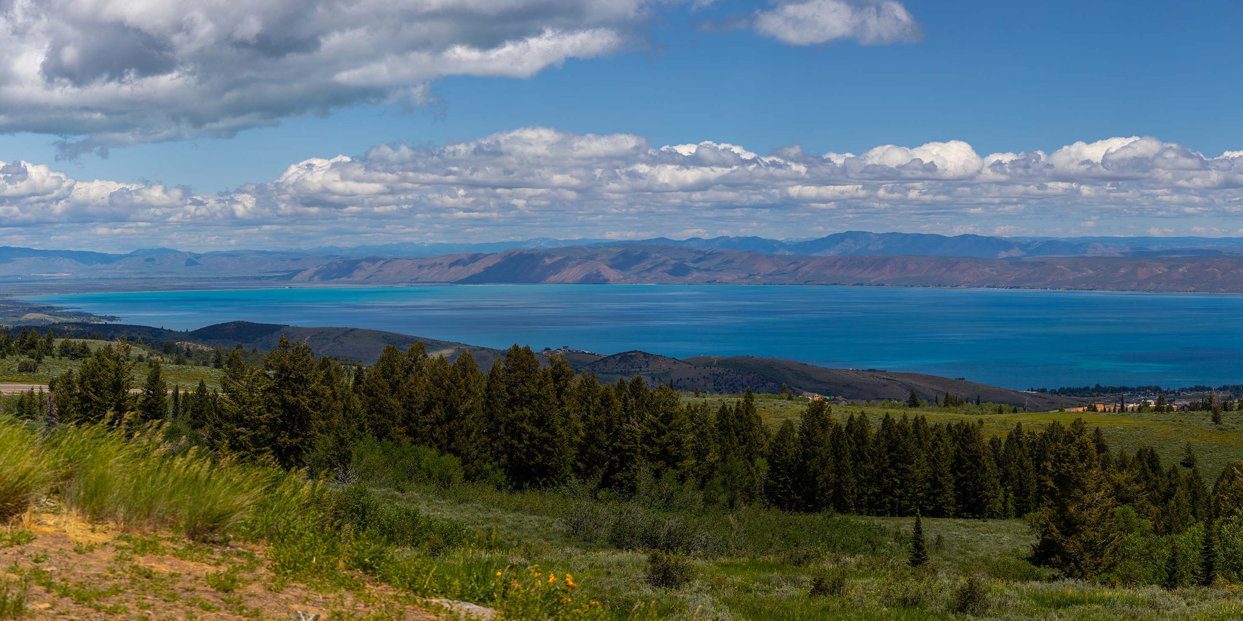
The drive alone is worth it. Coming over the ridge on Highway 89 north of Garden City, Bear Lake appears without warning — a sudden impossible blue that stops conversation mid-sentence. Turquoise is the word everyone reaches for, though it doesn't quite do it justice. On a clear July morning, with the sun high and the water calm, the color is closer to something you'd expect to find in the Caribbean than in a mountain valley on the Utah-Idaho border.
People have been making this drive for generations. Families who came as children now bring their own children, and their children's children, to the same beaches, the same raspberry stands, the same worn wooden docks. Bear Lake is that kind of place — less a destination than a ritual. The Raspberry Days festival every August. The Bonneville cisco dip-netting in January. The kind of summer weekend that becomes a family story told for decades.
At twenty miles long and eight miles wide, the lake is big enough to feel like an inland sea and intimate enough to feel like it belongs to you. The towns of Garden City on the western shore and Laketown to the south are unhurried places, built around the water and the seasons it brings. There are marinas and rental shops and ice cream stands and front porches with views that would cost a fortune anywhere else in the West.
It is, by any measure, one of the most beautiful places in Utah. And it is exactly what it appears to be — right up until the moment it isn't.
What Came Before
Long before Utah was Utah, before the Shoshone people summered in the Bear Lake Valley, before Jim Bridger and Jedediah Smith held their famous fur trader rendezvous on its southern shore in the 1820s, Bear Lake was already old. Formed by a shift along an ancient earthquake fault line that dropped the valley floor and filled it with water, the lake is estimated to be at least 250,000 years old. Some geologists believe it could be older still — perhaps several million years. In either case, it was here long before humans arrived to name it.
For most of that time, Bear Lake sat in quiet isolation. A natural berm of sand and sediment, shaped over millennia by wind and wave action, separated the lake from the Bear River to the north. The river went its way. The lake kept its own counsel. That separation lasted at least 11,000 years — roughly the entire span of recorded human civilization.
In that isolation, something remarkable happened. Cut off from outside water sources and fed instead by limestone-rich springs seeping through the mountains on the lake's western side, Bear Lake developed a water chemistry unlike anywhere else on earth. That chemistry produced the lake's famous turquoise color — calcium carbonate suspended in extraordinarily clear water refracting sunlight into a blue so vivid it seems almost artificial. It also produced something far more scientifically significant. Species of fish evolved inside Bear Lake that exist nowhere else on the planet — the Bonneville cisco, the Bonneville whitefish, the Bear Lake whitefish, the Bear Lake sculpin. Animals shaped over thousands of generations by a single lake's unique conditions, found nowhere else in the world.
Bear Lake was, in the truest sense of the word, irreplaceable.
That was still true in 1910, when a company called Telluride Power began looking at the Bear River Valley with a very different set of questions in mind.
1911
Telluride Power Company had a problem common to every electric utility in the early twentieth century American West — a fast-growing population that needed electricity, and a river whose flow was maddeningly inconsistent. The Bear River ran high and fast with snowmelt in the spring, then dropped to a fraction of that volume by late summer, just when farms needed water most and demand for electricity was at its peak. What the company needed was a way to store the spring surplus and release it on demand.
They found their answer in Bear Lake.
The engineering logic was straightforward. Bear Lake sat at a higher elevation than the Bear River's downstream channel. If you could redirect the river into the lake during high-flow spring months, store it there, then release it back into the river when needed, gravity would do the rest — carrying the water downhill through a series of turbines that would spin generators and produce electricity. Farmers downstream would get a reliable summer water supply. The company would get hydroelectric power. Everybody wins.
Beginning in 1911, crews dug a canal system connecting the Bear River to Bear Lake through a natural low point in the berm that had separated them for eleven millennia. A pumping station — the Lifton Pumping Plant — was constructed on the lake's north shore to move water back out when needed. By 1927, five hydroelectric generating plants had been built downstream along the river's path — Soda, Grace, Cove, Oneida, and Cutler — each one capturing energy from water released from the lake above.
The work took years. It was ambitious, expensive, and technically remarkable for its era. When it was finished, the Bear River no longer decided where it went. The company did.
Bear Lake — 250,000 years old, shaped by earthquakes, refined by isolation into something genuinely unique — was now also a reservoir. The tourists who would eventually come for the turquoise water and the raspberries were still decades away. For now it was simply infrastructure.
In 1920, a federal court formalized what the company had already built. The Dietrich Decree gave Telluride Power — by then reorganized as Utah Power and Light — a legally protected priority water right over most other downstream users. First in line. Ahead of farmers. Ahead of towns. Ahead of anyone who might come later with competing claims.
It was, by the standards of western water law, perfectly legal. It was also permanent.
What The Company Got
To understand what Telluride Power — and every corporate successor that followed — received from this arrangement, it helps to think about water the way a utility accountant might.
Water falling downhill is free electricity. You don't mine it. You don't refine it. You don't ship it. You simply position yourself at the bottom of a hill, build a turbine, and collect what gravity delivers. The larger the volume of water and the greater the drop in elevation, the more electricity you generate. The Bear River dropping out of the mountains of southeastern Idaho toward the Great Salt Lake offered plenty of both.
The five hydroelectric plants built downstream of Bear Lake between 1911 and 1927 were positioned like a staircase — each one capturing energy from water that had already passed through the plant above it. Water released from Bear Lake didn't just generate electricity once. It generated electricity five times on its way to the farms and cities waiting downstream. By the time that water reached a farmer's canal head or a city's intake pipe, it had already earned the company five separate paydays.
Today that system — now owned by PacifiCorp, the Portland-based utility that absorbed Utah Power and Light in 1989 — still operates. Still generates power. Still holds the same court-protected water rights secured in 1920. The Bear River hydroelectric system currently produces 77 megawatts of electricity, enough to power tens of thousands of homes across Utah, Idaho, and Wyoming.
PacifiCorp did not build Bear Lake. But for more than a century, they have held the legal right to fill it, drain it, and decide how much water moves through it and when. That right was granted by a federal court before most of the towns along the Wasatch Front existed in their current form. Before the interstate highway system. Before air conditioning made Utah's summers survivable for millions of residents. Before anyone was counting the level of the Great Salt Lake.
The water rights that govern Bear Lake today were written for a different world. They remain in force in this one.
What The Lake Lost
The color is real. So is the history behind it.
Not everything that entered Bear Lake through those new canals in 1911 was water.
The Bear River carried with it a different chemistry than the ancient springs that had fed Bear Lake for thousands of years. Where the lake's natural water was extraordinarily clear and rich with calcium carbonate — the compound responsible for that famous turquoise color — the Bear River brought sediment, different minerals, and a fundamentally altered water balance. The change wasn't immediate or dramatic. It didn't happen overnight. But it happened.
Scientists studying the lake's sediment layers can identify the precise moment the diversion began. The chemical signature of the water changed — measurably, permanently — right around 1911. It is written into the geology of the lake floor the way a scar is written into skin.
For the fish, the consequences were more final.
Bear Lake's endemic species — the creatures that had evolved over thousands of generations in isolation, shaped by conditions found nowhere else on earth — had no framework for what was coming. The Bonneville cisco. The Bonneville whitefish. The Bear Lake whitefish. The Bear Lake sculpin. Each one a product of 11,000 years of quiet, undisturbed adaptation. Several of those species did not survive the transition. They went extinct — not with any announcement, not as the target of any deliberate decision, but simply as a consequence of a business arrangement between a power company, a federal court, and the farmers of northern Utah and southern Idaho.
The survivors — and there were survivors — are still there today, still endemic, still found nowhere else on the planet. Researchers still study them. Conservationists still worry about them. In January each year, hardy souls still wade into the shallows at Cisco Beach with dip nets to scoop up spawning Bonneville cisco in what has become one of Utah's more unusual winter traditions. The fish adapted enough to endure. The ones that couldn't are simply gone.
There is one more loss that is easier to see, though less discussed. The 21-foot swing in lake levels — the bathtub being filled and drained on a seasonal schedule determined not by rainfall or snowmelt but by downstream irrigation demand — has shaped life along the Bear Lake shoreline in ways both practical and profound. Docks that float at one depth in May sit stranded on exposed lakebed by September. Shoreline property lines shift with the water. Beaches that are wide and welcoming in June become narrow strips of exposed sediment by late summer. The people who have built their lives and homes along Bear Lake's shores have learned to live with a lake that is never quite the same size twice.
They didn't design that arrangement. They inherited it.
What This Has To Do With The Great Salt Lake
Bear River Flows Into the Eastern Shore of the Great Salt Lake
What arrives at the Great Salt Lake is what remains after everyone else has taken their share.
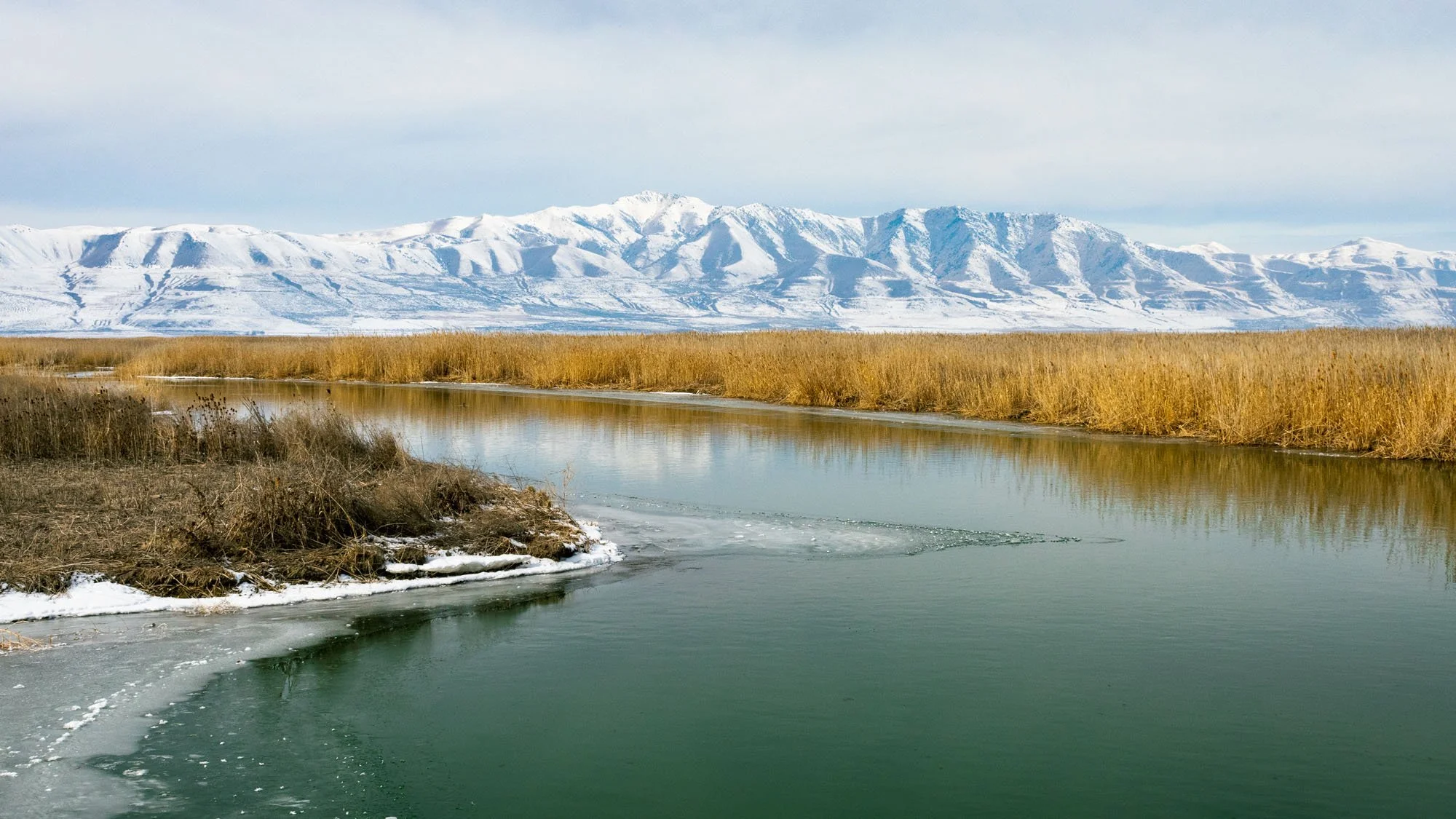
Draw a line on a map from the Uinta Mountains in northeastern Utah, up into Wyoming, across into Idaho, and back down through Cache Valley into Box Elder County. That line is the Bear River — 500 miles of travel to cover 90 miles of actual distance, crossing state lines five times before finally emptying into the eastern shore of the Great Salt Lake.
It is the lake's most important source of fresh water. Not one of several. Not a significant contributor. The Bear River delivers approximately 60 percent of all the freshwater that flows into the Great Salt Lake. Without it, the math on the lake's survival becomes very difficult very quickly.
That water passes through Bear Lake first.
Everything described in the previous pages — the 1911 diversion, the five hydroelectric plants, the court decrees, the seasonal filling and draining, the irrigation canals serving 150,000 acres of farmland across three states — all of it happens upstream of the Great Salt Lake. By the time the Bear River reaches the lake's eastern shore, it has already been stored, released, metered, allocated, farmed, evaporated, seeped into canal beds, and passed through turbines five separate times.
What arrives at the Great Salt Lake is what remains after everyone else has taken their share.
This is not a recent development. It is not the result of any single decision or any single administration or any single drought. It is the accumulated weight of more than a century of water management decisions made by states, companies, courts, canal companies, irrigation districts, and individual farmers — nearly all of whom had entirely legitimate claims to the water they were using, under laws that were written long before anyone thought to ask what the lake at the end of the river might need to survive.
Western water law — the system that governs all of this — operates on a principle called prior appropriation. First in time, first in right. The oldest water claims get filled before the newest ones. The Great Salt Lake, as a body of water rather than a farm or a city or a power company, has never held a water right of its own. It sits at the end of the line, legally speaking, receiving whatever is left over when everyone ahead of it has been served.
For most of the twentieth century, enough was left over. The lake fluctuated but survived. Then the population of the Wasatch Front doubled. Then it doubled again. The farms didn't shrink. The power company didn't relinquish its decrees. The canal systems kept flowing. And the lake began to disappear — not all at once, but steadily, measurably, year by year, foot by foot, in a decline that is now visible from space.
The Bear Lake story and the Great Salt Lake story are not two stories. They are one story, told from different points along the same river.
The Summer You Go Back
Go anyway.
Drive up Highway 89 and watch Bear Lake appear over the ridge without warning, that impossible turquoise stopping conversation mid-sentence the way it always has. Get the raspberries. Rent the boat. Let the kids run into the water. Sit on the dock at dusk when the color of the lake shifts from blue to something closer to silver and the mountains go dark around the edges. It is still one of the most beautiful places in Utah. Nothing in this story changes that.
But you may find yourself looking at it differently now.
You may notice the waterline — where it sits against the shore in July compared to where the exposed sediment suggests it was in April. You may think about the Bonneville cisco somewhere beneath the surface, descendants of creatures that survived a transformation their ancestors never asked for. You may look out at that turquoise water and understand that its color is the result of chemistry that was altered more than a century ago and has never returned to what it once was.
You may think about the five hydroelectric plants downstream, humming quietly, doing exactly what they were designed to do in 1911. You may think about the farmers in Cache Valley and Box Elder County drawing water from canals that have served their families for generations, under rights that were secured before their grandparents were born. You may think about the Bear River making its improbable 500-mile journey south, crossing state lines five times, passing through turbines and irrigation headgates and evaporating from ten thousand acres of alfalfa fields, before whatever remains of it reaches the eastern shore of the Great Salt Lake.
You may think about what the lake needs, and what it gets, and the distance between those two numbers.
Or you may just eat your raspberries and watch the water and let the afternoon go. That is allowed too.
Bear Lake will be there either way — ancient and altered, spectacular and complicated, exactly what it appears to be and so much more than that, all at the same time.
Just like the West itself.
This article was produced with the assistance of artificial intelligence and independently reviewed for editorial accuracy by Mountain & Main Magazine. All factual claims have been verified prior to publication.