A 3,100 MILE TRAIL VISION

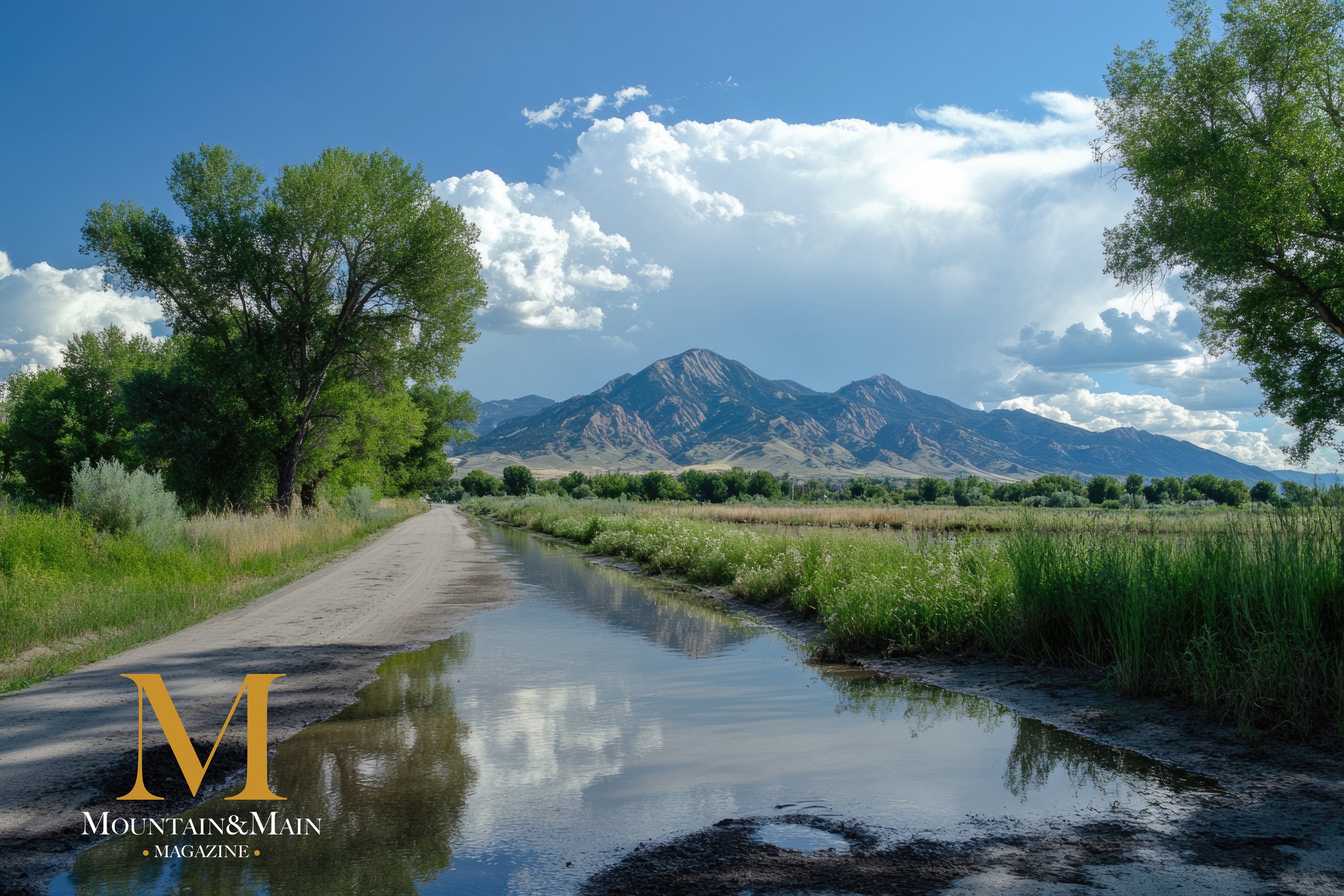
– People run and ride bikes on Murdock Canal Trail in Utah Valley.
How the Utah Trail Network Could Change Life Along the Wasatch Front
Utah has put a massive new idea on the map—literally.
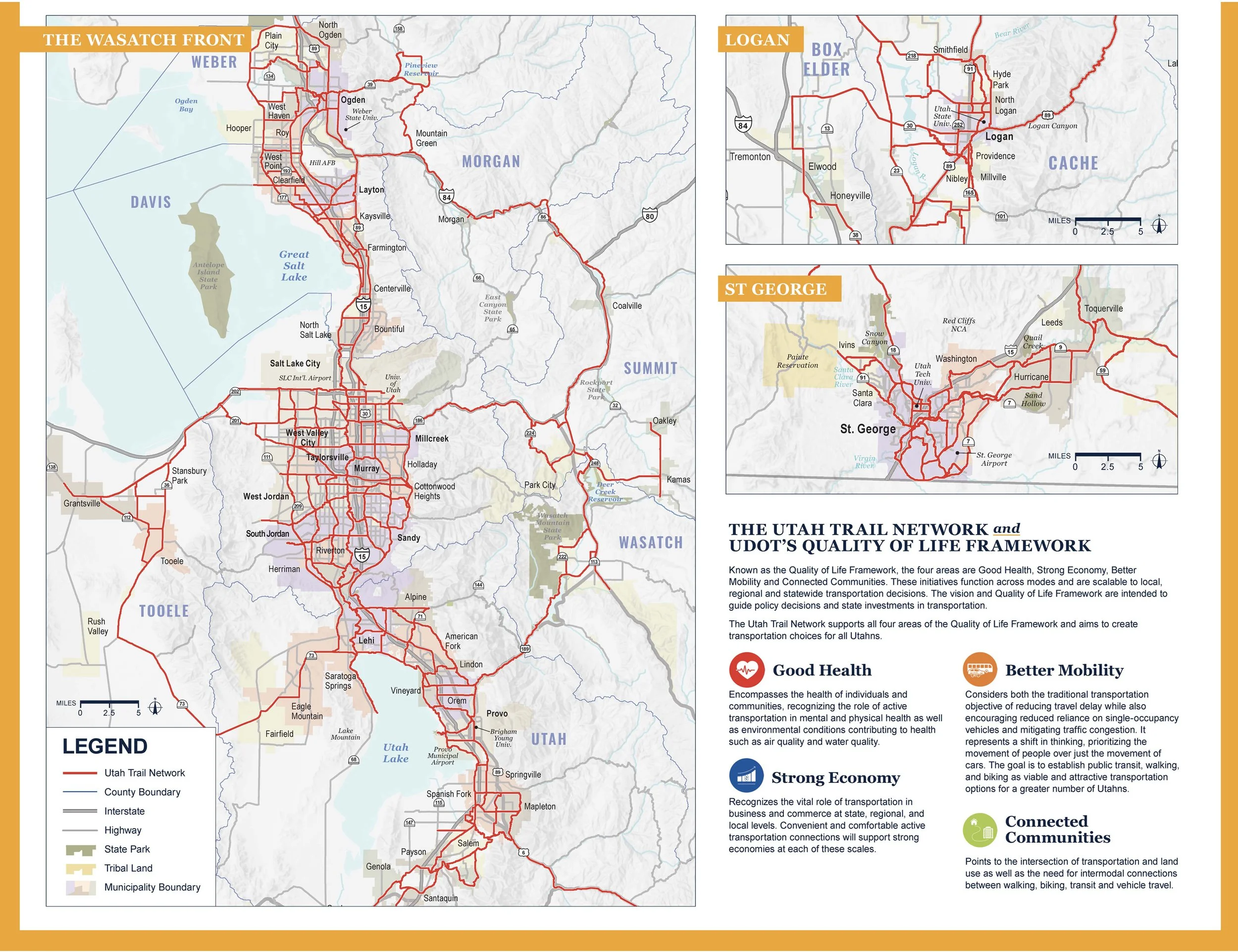
In late October, Gov. Spencer Cox unveiled the completed master plan map for the Utah Trail Network, a proposed web of 3,100 miles of paved, connected trails designed to link nearly every corner of the state.
It’s an ambitious promise: when the system is built out over the coming decades, 95% of Utahns will live within a mile of a paved trail, with routes connecting 208 towns and cities, 33 colleges and universities, 74 major transit stations, 6 national parks and 25 state parks.
For those of us who live along the Wasatch Front—especially in Utah and Salt Lake counties—this isn’t just a “someday” vision. It’s the next evolution of the trail corridors we already know: the Jordan River Parkway, Murdock Canal Trail, Provo River Parkway, Parley’s Trail/S-Line Greenway, and others that already stitch our communities together.
From Big Idea to Master Plan
The Utah Trail Network started as a concept Gov. Cox floated in 2022: a kind of “interstate system of paved trails” that would give Utahns a safe, car-free way to get around their communities and, if they choose, across the state—eventually allowing someone to bike, walk or roll from Logan to St. George on connected paths.
Lawmakers followed in 2023 by creating the Active Transportation Investment Fund, setting aside $45 million in one-time money and up to $45 million per year for non-motorized trail projects.
On Oct. 28, 2025, Cox used his keynote at the Utah Transportation Conference to reveal the first full master plan map:
3,100 total miles of paved trails
2,600 miles of new construction
500 miles of existing paved trails folded into the system
UDOT’s Trails Division spent the past year working with local governments and planning agencies to draw what they describe as the “backbone” network—the high-priority routes that function like interstates for bikes, pedestrians, and other human-powered travel.
The map is aspirational, not a binding construction schedule. It will be updated about every four years as feasibility studies are completed, plans are refined and local conditions change.
– West Jordan Utah. Panoramic Landscape of Jordan River Parkway Trail and Legacy Parkway Trail with Rocky Mountains in the Background.
What It Means for Utah & Salt Lake Counties
For Mountain & Main readers, the most immediate impact of the Utah Trail Network is how it upgrades and connects the paved routes we already rely on.
A few standouts highlighted in state and regional coverage:
Jordan River Parkway: Roughly 40 miles of paved trail from Utah Lake, through Salt Lake County, toward the Great Salt Lake. It already serves as the north–south spine for both counties and is part of the “Golden Spoke” corridor.
Murdock Canal Trail: A 17–18 mile paved path running from Orem through Lindon, Pleasant Grove, American Fork, Highland and into Lehi. The Utah Trail Network map treats it as a key Base Network segment, with connections to the Jordan River Parkway near Thanksgiving Point.
Provo River Parkway: A 15-mile paved corridor from Utah Lake State Park through Provo to Vivian Park in Provo Canyon, with planned extensions up the canyon and along the west shore of Deer Creek Reservoir to Heber Valley.
Parley’s Trail & S-Line Greenway: An east–west route that ties the foothills near the Bonneville Shoreline Trail into urban Salt Lake City and the Jordan River corridor. Network planners are looking at gap closures through Parley’s Canyon to better link Park City-area trails with the Salt Lake Valley.
More Than Recreation: A New Way to Commute
While the photos in most news stories show scenic riverbanks and canyon views, UDOT officials have been blunt: this is first and foremost a transportation project, with recreation as a huge bonus.
Trails Division Director Stephanie Tomlin told the Deseret News that Utah simply “can’t keep building lane miles” to handle future population growth. Instead, the agency is trying to give people safe alternatives for the countless trips under three miles that most of us take every week—runs to the store, school drop-offs, or a commute to a nearby campus.
The plan allows:
Walking, running and rolling (wheelchairs and mobility devices)
Bicycles and Class 1 & 2 e-bikes
Scooters and other human-powered devices
but keeps out cars, trucks and off-highway vehicles, with paved routes physically separated from traffic wherever possible.
Outdoor advocates have called it everything from a “bicycle interstate system” to a “car-free spine” for accessing classic mountain-bike and bikepacking routes statewide.
Along the Wasatch Front, the daily benefits might feel more practical:
A BYU student in Provo taking the Provo River Parkway instead of fighting University Avenue traffic
A Lehi family hopping on the Murdock Canal Trail to hit the Frontrunner station or a Saturday soccer game without loading bikes onto the car
A Sugar House resident using the S-Line Greenway and Parley’s Trail to reach downtown or a TRAX stop
Why It Matters for the Wasatch Front Lifestyle
If you zoom out, the Utah Trail Network lines up almost perfectly with the values Mountain & Main is trying to celebrate in our coverage of Utah and Salt Lake counties:
Health & longevity: Stories like Sugar House resident Christina Gulla, who rides a 90-minute loop several times a week in her 70s, underline how access to safe, nearby trails keeps people moving well into later life.
Family-friendly recreation: Paved, separated trails give families a way to ride with kids without white-knuckling every intersection.
Clean air & traffic relief: Every short trip that can move to a trail is one less car in the mix on I-15, Redwood Road or State Street.
Local connection: The network is designed to link neighborhoods with downtowns, schools, parks and transit hubs, making it easier to live a “15-minute community” lifestyle even in a growing metro area.
How to Explore — and What to Watch Next
UDOT has launched a dedicated Utah Trail Network website with an interactive master plan map. You can zoom in on Utah and Salt Lake counties, follow future routes through your neighborhood and see how the state envisions closing key gaps like Parley’s Canyon, 300 West/South Temple, or the connections between Utah Valley’s major trails.
For future Mountain & Main coverage, here’s what we’ll be watching:
Which Wasatch Front projects actually get funded and scheduled first
How local cities like Lehi, Draper, Sandy, Provo, Orem and Salt Lake adjust zoning, crossings and trailheads to support the network
Stories of everyday trail users—from e-bike commuters to youth teams doing recovery rides along the river
Opportunities for public input as UDOT updates the map and prioritizes segments
The Utah Trail Network is still lines on a map. But for those of us who already live along some of the busiest trail corridors in the state, it’s also a glimpse of a future where grabbing a bike or lacing up your shoes feels just as natural as reaching for your car keys.
And that’s a future very much in line with the Mountain & Main vision: a Wasatch Front where staying active, connected and outside is simply part of everyday life.