
Snowpack Check: What a Lean Start Means for Winter Sports Along the Wasatch Front
Early winter in Utah can be as much about patience as powder.
Utah Sports Ink — Winter Sports
By mid-December, the ritual is familiar along the Wasatch Front. Skiers refresh forecasts, riders debate base depths, and winter recreationists scan mountain cams, all asking the same question: How are we really doing out there?
According to the agencies that track Utah’s snowpack most closely, the answer right now is clear—even if it isn’t cause for panic. Snowpack across the Wasatch Front is running below historical median levels for this point in the season, a reminder that early winter in Utah can be as much about patience as powder. For winter sports enthusiasts, the impact is already being felt—but it’s also shaping expectations for what could still be a very dynamic season.
What “Below Normal” Actually Means
Snowpack is measured using Snow Water Equivalent (SWE)—the amount of water contained in the snowpack—and compared to long-term medians dating back decades. It’s the most reliable way to judge how much “real” snow is on the ground, not just how deep it looks.
Across Wasatch Front basins, SWE currently sits at roughly half of the historical median for mid-December. In practical terms, that means the mountains are skiing, but the foundation that supports full terrain openings, deep off-piste lines, and carefree powder laps is still a work in progress.
Importantly, this is not unusual for Utah. Some of the state’s best winters have started slowly, only to flip the switch with sustained storm cycles in January and February.
On-Mountain Reality: What Skiers and Riders Are Experiencing
Groomers Are the MVP
Even in lean early seasons, Wasatch Front resorts excel at delivering quality groomed skiing. Snowmaking, strategic grooming, and colder overnight temperatures have helped maintain firm, consistent conditions on main runs at Alta, Snowbird, Brighton, and Solitude.
For many skiers—especially families, intermediates, and those logging weekday laps—the experience remains strong. Corduroy mornings and reliable surfaces are often the unsung heroes of early winter.
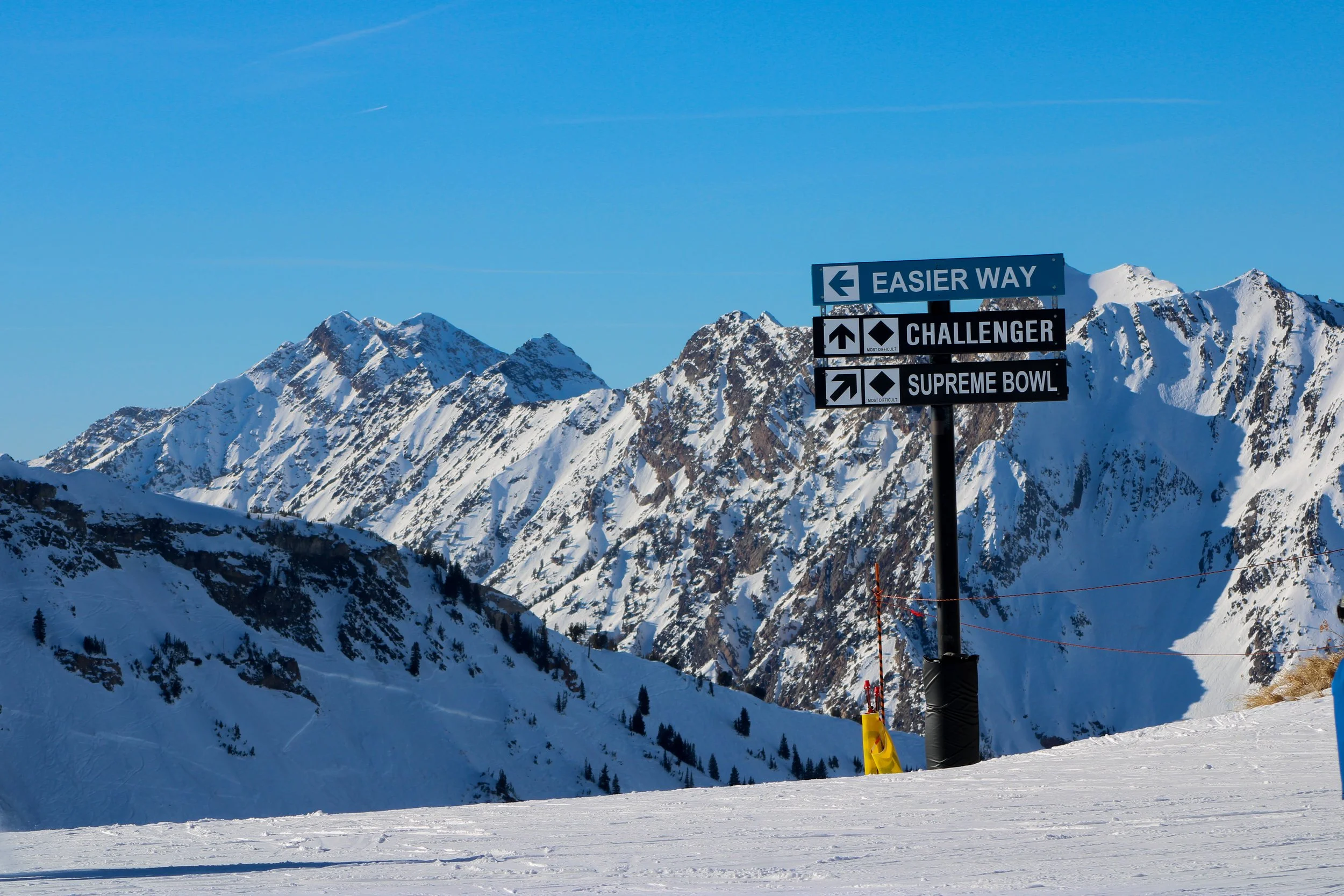
Terrain Openings Come More Slowly
Where the reduced snowpack shows itself most clearly is in advanced and expert terrain. Steeper lines, bowls, cliff zones, and tree skiing require a deeper natural base to safely open.
Areas like:
Snowbird’s Mineral Basin
Solitude’s Honeycomb Canyon
Brighton’s tree zones
Alta’s higher-elevation off-piste terrain
are all heavily dependent on natural snowfall. When base depths lag, resorts take a cautious approach—and for good reason. Thin coverage increases injury risk and puts long-term terrain health at stake.
The Powder Question
Utah’s reputation as a powder paradise isn’t built on December alone. Historically, January through March deliver the biggest snowpack gains. That’s when sustained storm cycles stack base depth quickly, transforming conditions seemingly overnight.
A single multi-day storm can:
Add feet, not inches, to base depths
Unlock terrain that’s been waiting on coverage
Change a “conservative” season into a memorable one
For skiers and riders, this means managing expectations early while staying ready to pounce when the pattern shifts.
Backcountry & Winter Recreation: A More Serious Conversation
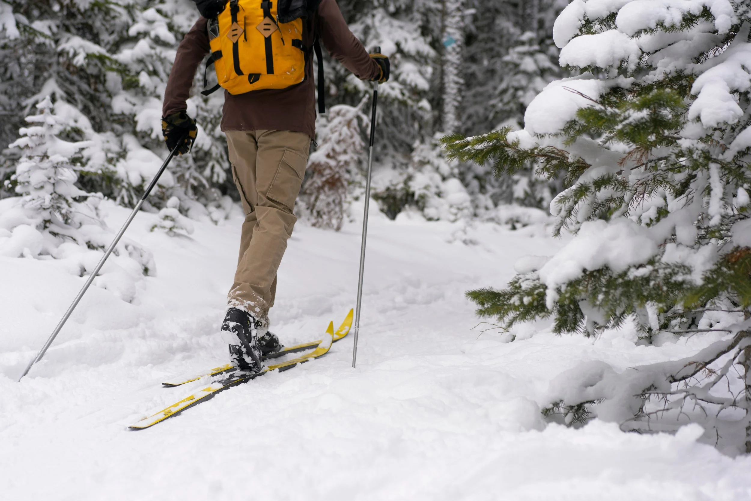
While resorts can adapt to a lean start, backcountry users don’t have that luxury.
Shallow snowpacks often create:
Weak basal layers
Faceted snow near the ground
More complex avalanche conditions
Early-season backcountry skiing, splitboarding, snowshoeing, and Nordic touring require extra caution. Thin coverage also increases the risk of injuries from hidden rocks, logs, and uneven surfaces—especially in popular zones near Big and Little Cottonwood Canyons, Millcreek Canyon, and foothill trail systems.
The message from avalanche forecasters and snow professionals is consistent: early winter demands conservative decision-making, even when the mountains look inviting.
How Resorts Adapt to Lean Starts
Wasatch Front resorts are experienced in navigating winters that don’t follow a perfect script. When snowpack lags, they adjust by:
Prioritizing snowmaking on high-traffic runs
Focusing grooming resources strategically
Delaying terrain openings until coverage is safe
Channeling skier traffic toward areas with the strongest base
The result is a season that still offers quality days on the hill—just with a different rhythm.
Why There’s No Reason to Write Off the Season
If Utah winters have taught us anything, it’s that December doesn’t get the final word. Snowpack is cumulative, and the mountains can recover quickly when storms align.
For Wasatch Front winter sports enthusiasts, the outlook is best described as watchful optimism. The foundation may be thinner than average right now, but history suggests there’s plenty of runway left for conditions to turn.
What to Watch Going Forward
As the heart of winter approaches, skiers and riders should keep an eye on:
Sustained storm cycles rather than single snowfall totals
Rising basin SWE percentages
Temperature trends that preserve snow quality
Terrain announcements from resorts as coverage improves
In Utah, momentum matters—and once it starts building, it often doesn’t stop quietly.
The Utah Sports Ink Take
This winter may reward patience more than instant gratification. But along the Wasatch Front, patience has a way of paying off. From groomer days that keep legs fresh to the promise of deeper turns ahead, the season remains wide open.
The snowpack will tell its story one storm at a time. And when it does, Utah’s winter sports community will be ready.